Backpacking to Cataract Pass via Nigel Pass
One of the remote and spectacular backpacking trips in Banff National Park takes you to Cataract Pass via Nigel Pass and into the stunning White Goat Wilderness Area. As a day hike it’s about 26 km return – too much if you want to explore the wilderness area. I’d recommend a two-to-three day backpacking trip. That way you’ll have a full day to wander through the magnificent mountains, empty of people, on the far side of Cataract Pass.
The upside to backpacking into the White Goat Wilderness Area via Cataract Pass is the ability to random camp. No backcountry reservations are needed, so you can choose a good weather window.
A backpacking trip up and over Cataract Pass is not for the inexperienced. You need a skill set that includes route-finding, the ability to ascend and descend steep terrain, including snow if it’s early in the season, backcountry camping experience while practicing the Leave No Trace principles, and the know how to deal with bears.
This post includes some affiliate links. If you make a qualifying purchase through one of these links, I will receive a small percentage of the sale at no extra cost to you. Thank you very much for your support.
Why hike or backpack to Cataract Pass?
If you like off the beaten path hikes where you’re unlikely to see many humans, then it is well worth backpacking to Cataract Pass on the border of Banff and the White Goat Wilderness Area. However, if you prefer well-marked routes and the presence of other hikers, this is not the hike for you.
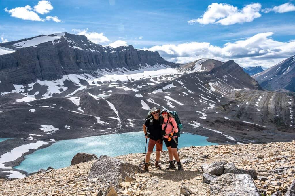
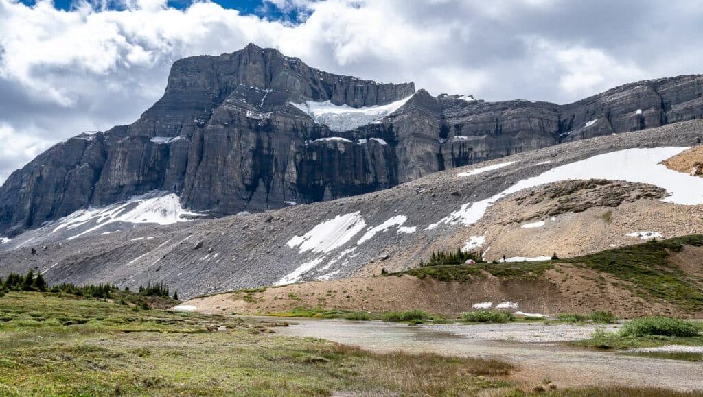
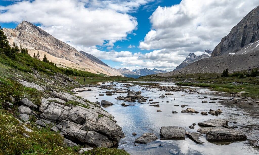
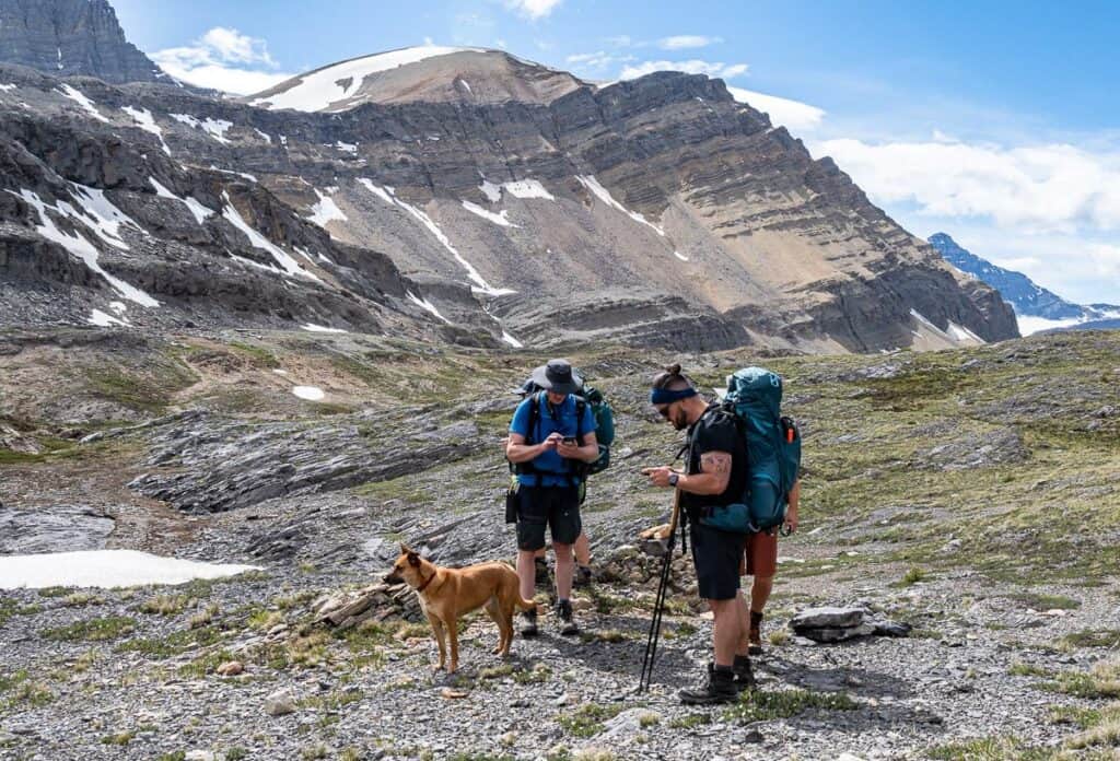
The hike up and over Cataract Pass takes you into a remote and spectacular area. The reward as you can see in the photos – big views, glaciers, wildly cooked rocks, interesting and colourful terrain, wildflowers, and the beautiful turquoise-blue Brazeau River. A bear sighting for us was a bonus.
You might also like: 10 + Best Backpacking Trips in Banff National Park
How to get to the trailhead
The Nigel Pass trailhead is easy to find. It’s here on Google Maps. There’s a signed turnoff on the north side of Highway 93 – the Icefields Parkway- about a kilometre after the big climb up from the valley – and a few hundred metres after the turnout to Panther Falls.
From Saskatchewan River Crossing it’s 37 km north. From the Columbia Icefield Centre, it’s 12.7 km south. And it’s just 3.7 km south of the hard to miss parking lot for Parker Ridge.
Backpacking to Cataract Pass quick trail stats and need-to-know info
Distance: 14.8 km one way to our campsite in the White Goat Wilderness area; it’s 13 km one way to Cataract Pass.
Elevation gain: Approximately 640 metres to Cataract Pass
Time needed: We took 7.5 hours one way. We spent quite a bit of time figuring out the best route down the steep slope on the final approach to the campsite.
GPS Coordinates: Nigel Pass, Cataract Pass, and the location shown on Organic Maps, our campsite location on Organic Maps
Permit requirements: You do need a National Parks Pass (though entrance fees are waived until September 2, 2025) to park at the Nigel Pass trailhead. You do not need a campsite reservation if you plan to camp in the White Goat Wilderness Area.
Maps needed: We use Organic Maps, an offline hiking app which is free. For a paper map, you’ll need Gem Trek Columbia Icefield or Columbia Icefield 83C/3.
Best time for backpacking to Cataract Pass
We did the backpacking trip to Cataract Pass over the second weekend of July. The bugs were lose-your-mind AWFUL through the meadows on the way to Nigel Pass. Once we started heading up the Brazeau River things improved. There were also several snowfields we crossed.
Consider the backpack to Cataract Pass in August or early September instead to avoid both the bugs and the snow. Pack a pair of leg gaiters just in case you do run into snow and bug repellent if it’s been a wet summer.
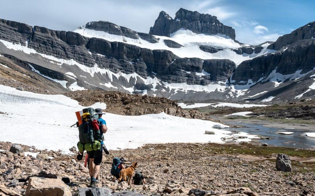
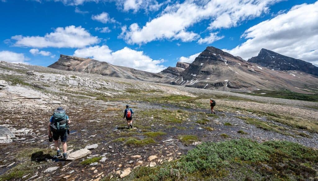
Trail Overview: Nigel Creek Trailhead – Nigel Pass – Cataract Pass – White Goat Wilderness campsite
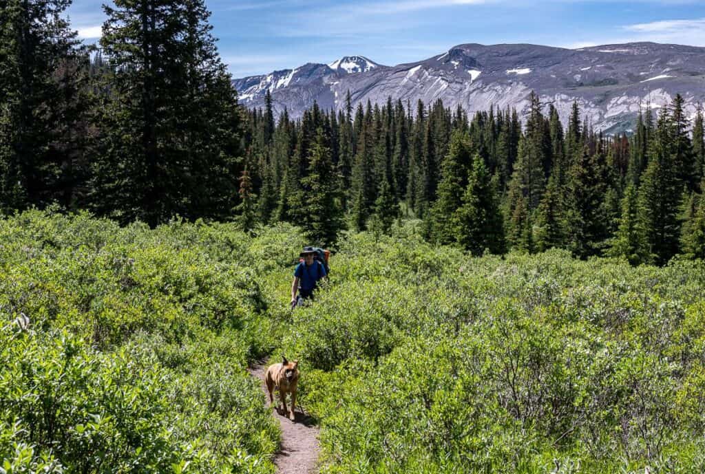
Nigel Pass trailhead to Nigel Pass
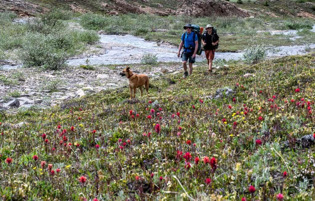
John and I had done the hike to Nigel Pass on two other occasions, so there were no surprises for me – other than I was very tired by the time I got there. That’s not like me, but I’d been going full tilt for months in preparation for a move happening a few days after this trip. Fortunately, lunch at the pass revived me and the rest of the backpacking trip to Cataract Pass was great.
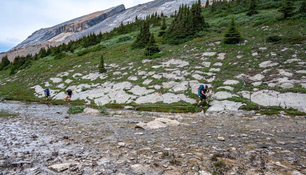
It’s a straightforward 7.2 km hike with 365 m of elevation gain to Nigel Pass. You start on an old fire road, cross Nigel Creek and then start heading up through trees that give way to meadows the higher you go. There is a river crossing right below Nigel Pass. The water isn’t deep but it’s very cold.
I took off my hiking shoes and put on my sandals but most of the group log and rock hopped across. Once on the other side of the Brazeau River there is a sign that says the trail is unmaintained going forward. No surprises there.
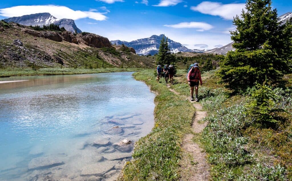
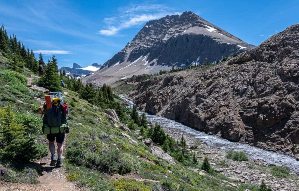
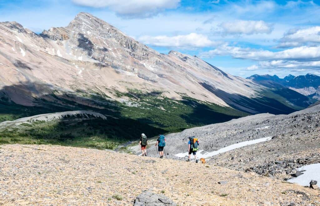
Into the wild: Nigel Pass to Cataract Pass
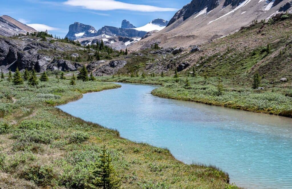
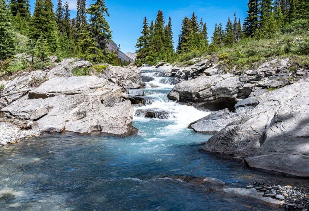
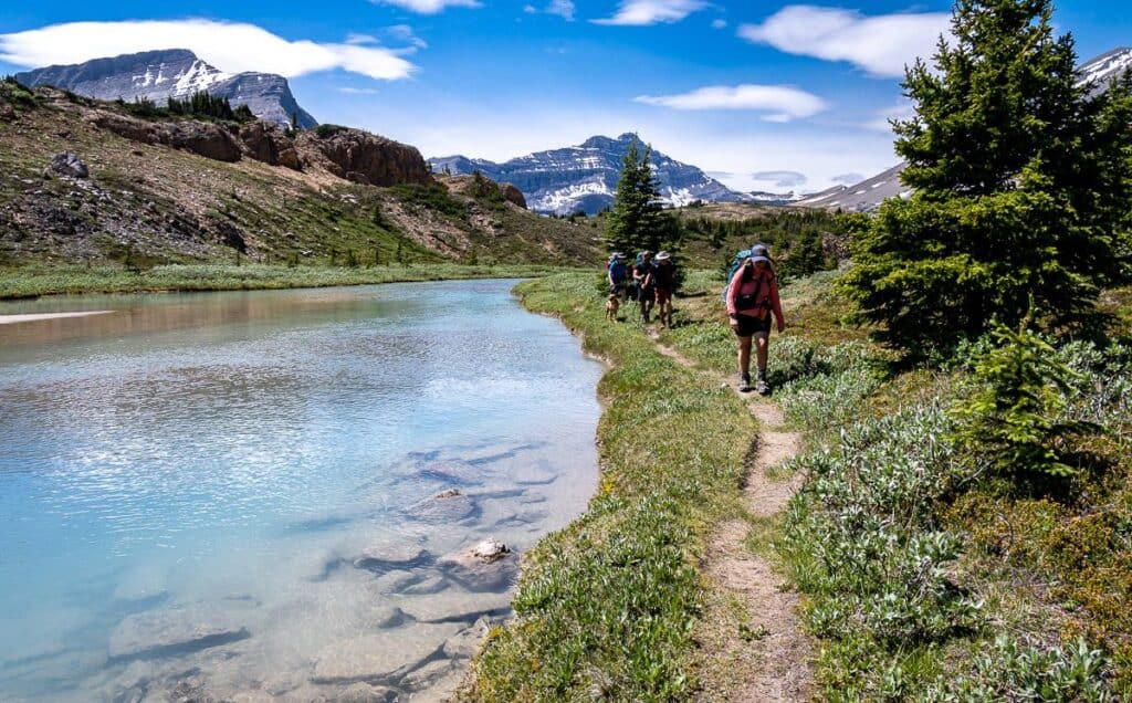
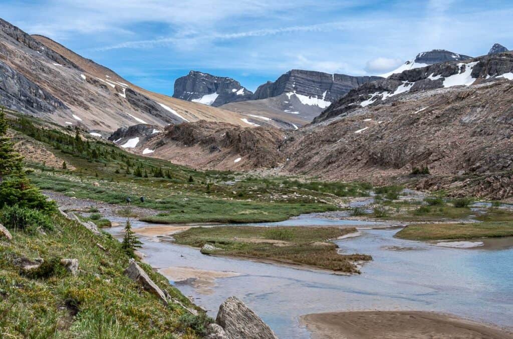
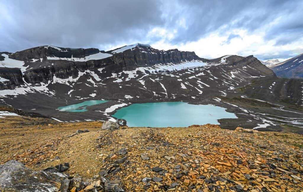
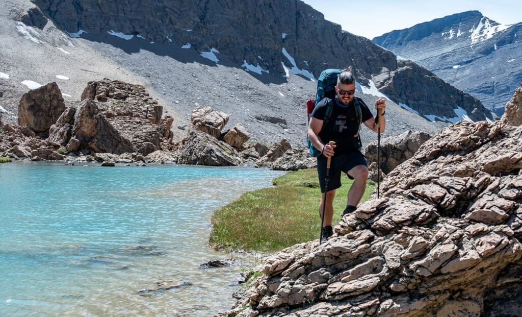
After crossing the Brazeau River turn right and head upstream on a well-used trail. In no time you’re in next-level mountain scenery. The Brazeau River slows, and the glacial silt gives it that beautiful turquoise-blue colour we all love so much.
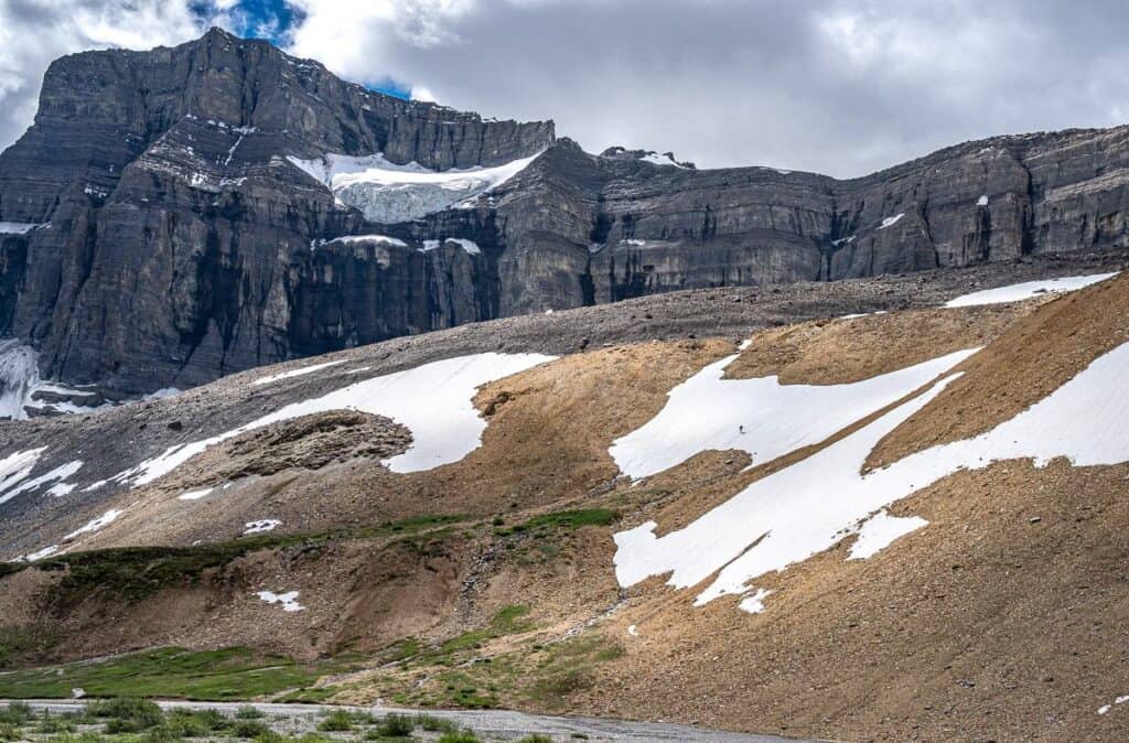
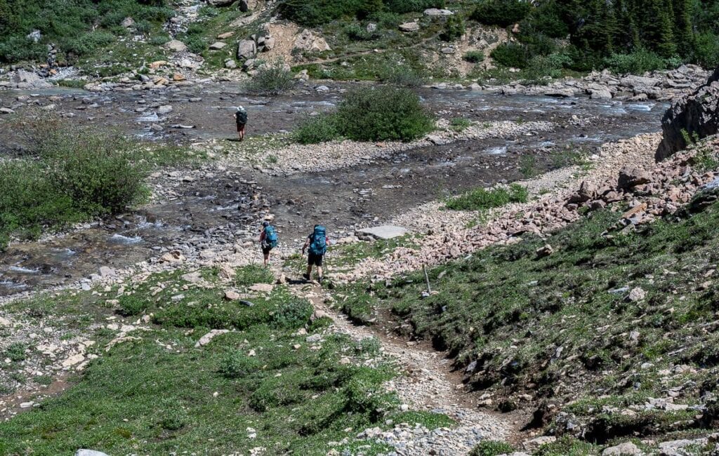
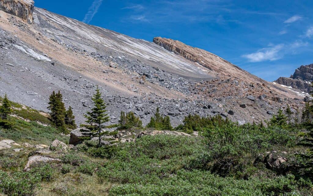
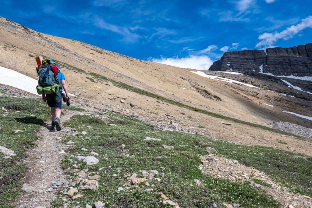
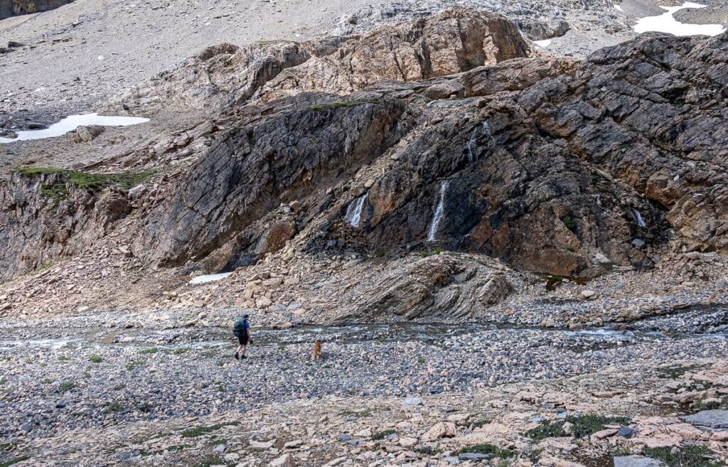
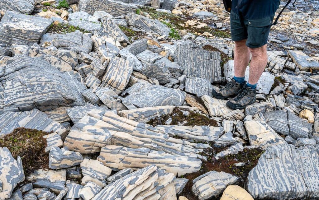
Look up on your left and you’ll see where a massive chunk of the mountain sheered off to create the boulder debris you must negotiate. The path through the boulders is generally well-defined. There was one short section that looked dodgy, but it just required going down into and then climbing out of the boulders.
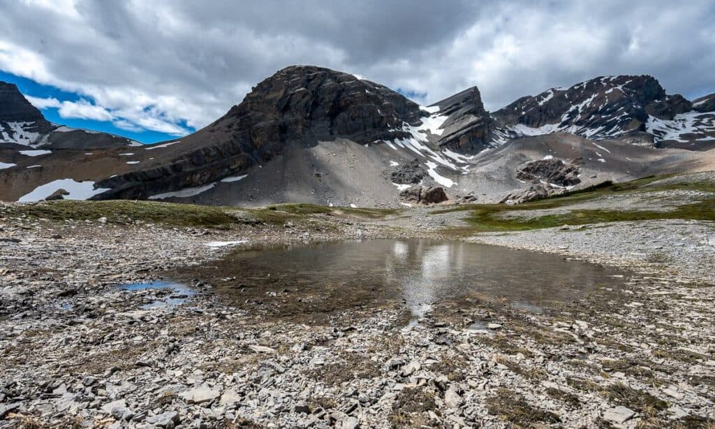
Near the end of the boulders, drop down to the river and walk along a narrow band of dirt and grass. Continue backpacking to Cataract Pass by rock-hopping across the river and then gradually up a flat section on broken rock. When your round the corner, look up to see Cataract Pass on the left.
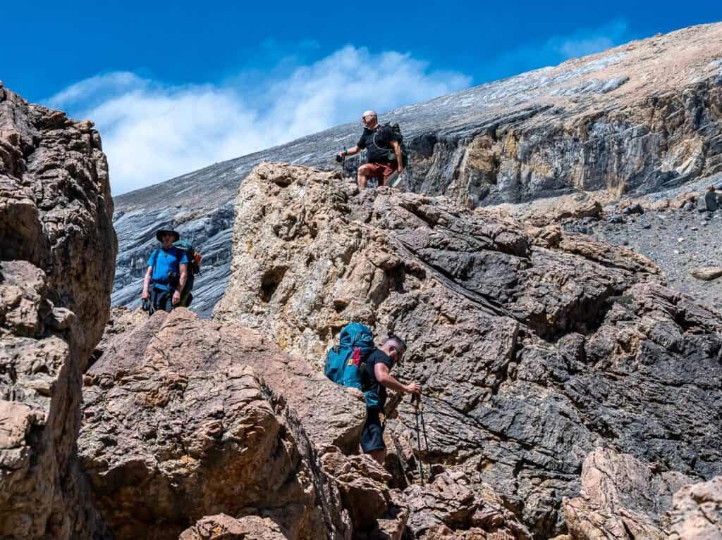
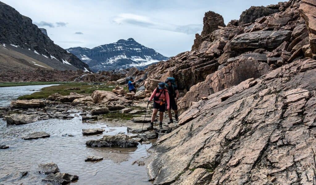
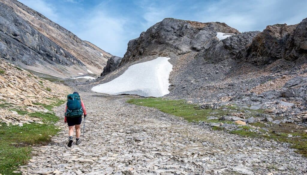
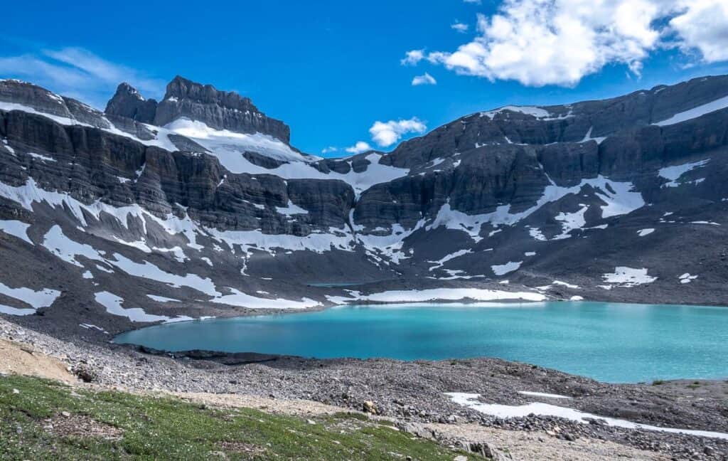
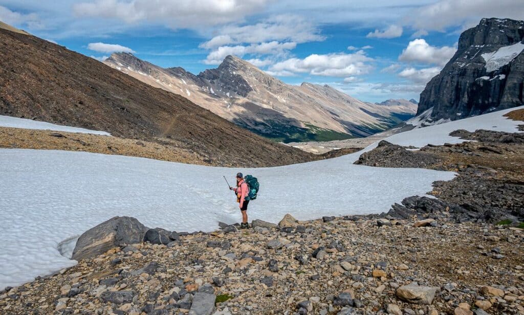
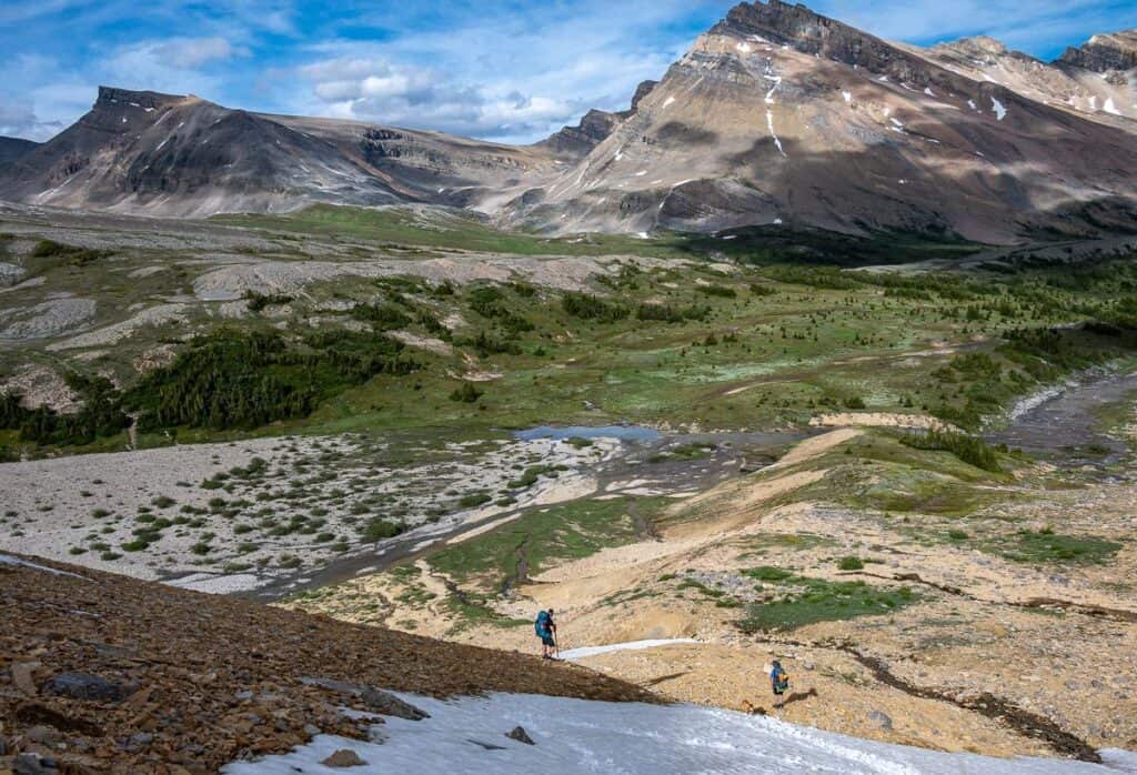
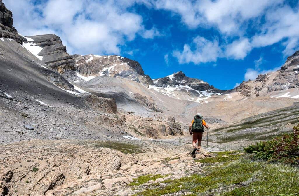
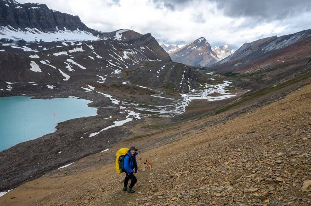
Before you start backpacking up the well-defined trail towards Cataract Pass, you’ll have to cross ether a snowfield or a scree-filled area depending on the time of year. Gemma is on that slope in the picture below. It leads to some rocks where you get great views of Cataract Lake (not named on maps).
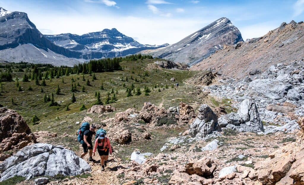
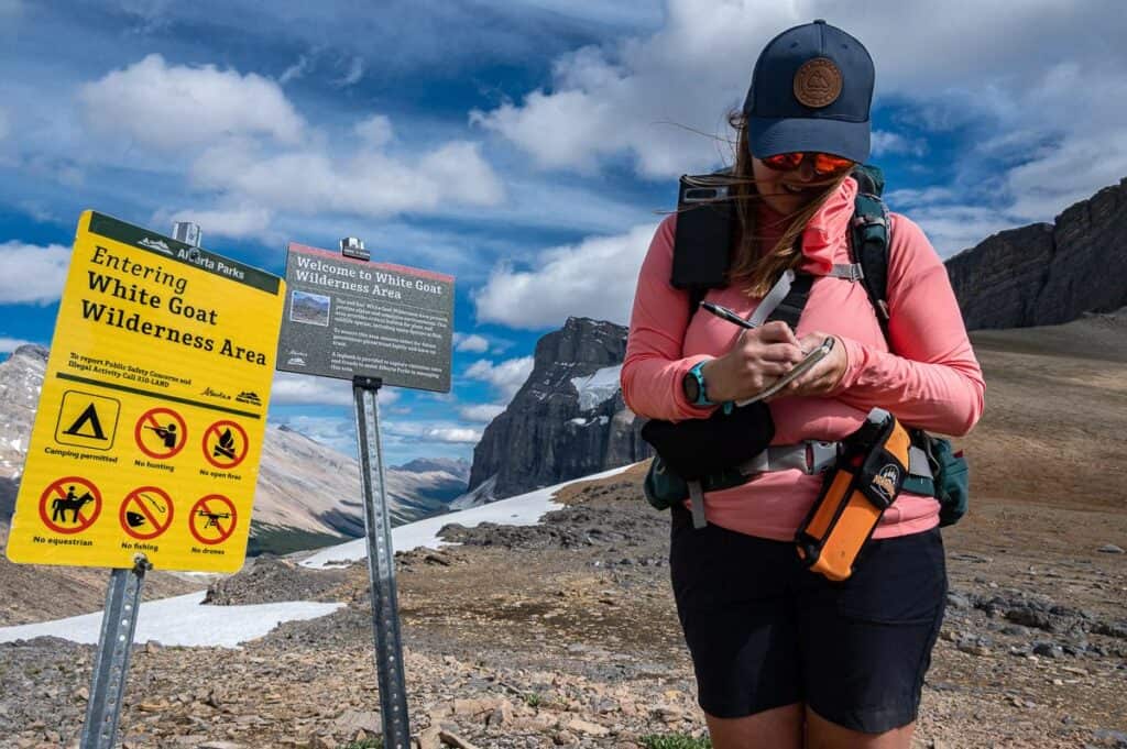
As you start the climb up towards the pass, you’ll notice two smaller turquoise lakes tucked away high in the mountains. The climb steepens part way up to Cataract Pass and the grade reportedly reaches 45 degrees. It sure felt like that to me as my calves were screaming at me. Exercise caution where the trail narrows and focus on good foot placement. Round the top and voila – a sign saying that you’ve arrived at the boundary of Banff National Park and the White Goat Wilderness.
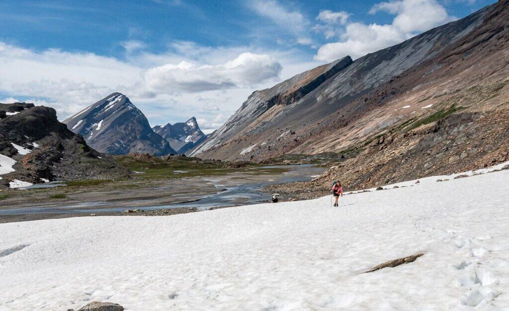
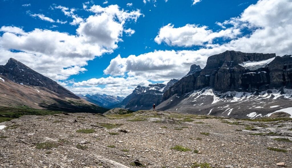
Cataract Pass to our White Goat wilderness campsite
The descent from Cataract Pass started off easily enough. We crossed a small snowfield near the summit and then followed a boot beaten trail down to a point where it steepened considerably. We looked at each other and wondered how we would safely get down.
John opted for steep snow though you couldn’t see over one part of it. He got down safely and fast. I followed in his footsteps planting a pole, so I always had three points of contact. Thomas opted for steep scree – so the bottom line, figure out where you are most comfortable and what looks safest. Gemma and JR also went for the snow.
From the bottom of the snowfield to our campsite, it was a five-minute walk.
Cline River
Side trip from our campsite
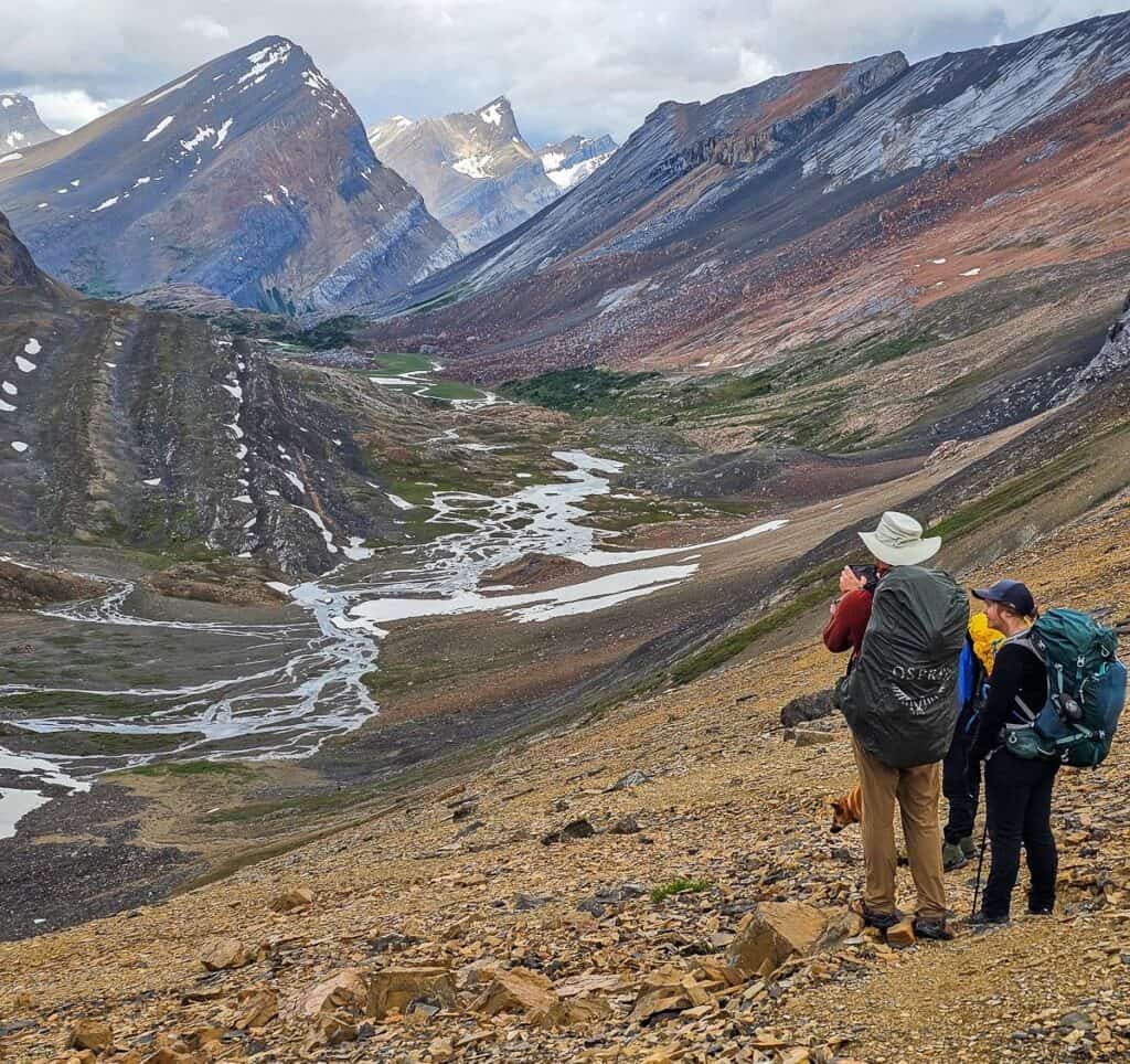
After a lazy morning of drinking coffee in camp we headed out to explore. We had contemplated hiking up Cline Pass – 3 – 4 km away because I’d read about the amazing views of the Valley of the Five Lakes on the far side. Apparently at least a dozen lakes in a moonscape like setting can be seen.
But loose boulders and the potential for rockfall put me off. From a distance it didn’t look so bad – so maybe there will be another time. A helmet would be a worthwhile addition if you plan to go.
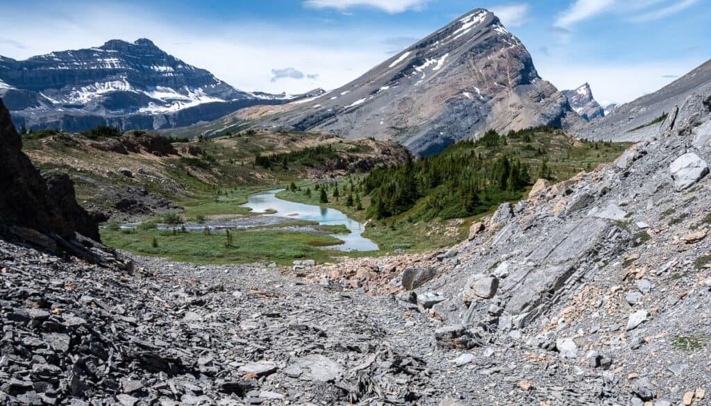
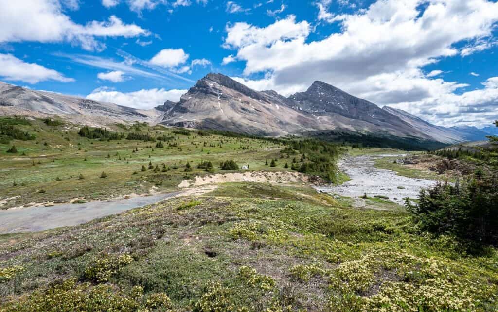
Instead we just wandered about for about three hours, savouring the quiet, the incredible rocks, wildflowers, and the views looking down towards the Cline River. The rest of the day we spent napping and reading.
Campsites and backcountry permits
Backcountry campsite permits
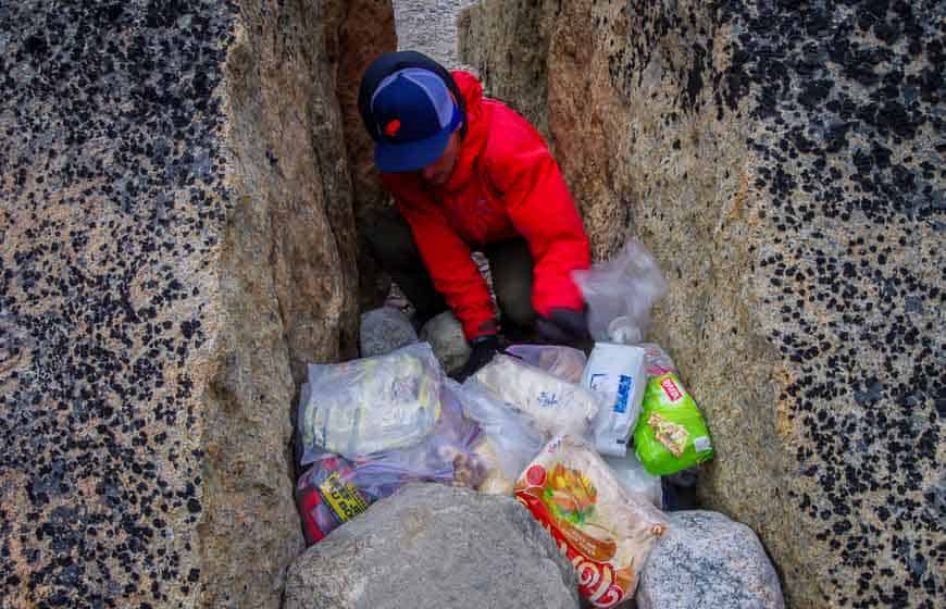
Once you enter the White Goat Wilderness Area, you can wild camp. That means you don’t need a reservation or permit, so its free. But please be a good person and pack out everything you packed in – and leave no trace of you ever being there.
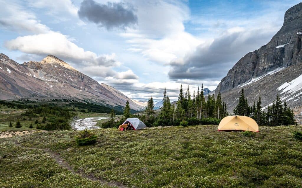
Tent spots near Cataract Pass
We arrived at our chosen campsite at 6:30 PM. None of us had any interest in hiking further to find a different or better campsite, especially with no one else around. At the bottom of Cataract Pass where three of us camped, there wasn’t a lot of flat ground. But on the far side of Cataract Creek, Gemma and JR found lots of flat ground and a good place to pitch a tarp in the trees.
Bear safety and food storage
Bears are always top of mind in the Canadian Rockies. You can backpack with a bear vault – and we were required to do just that to Grizzly Lake in the Yukon’s Tombstone Mountains. Another option is the Ursack bear resistant bag. We used these while backpacking off trail in Kluane National Park. Our guides swore by them, but they do add weight.
In Auyuittuq National Park, we would cover all the food with rocks and make a giant cairn every night. That would be yet another option.
What we did was put all our food in a waterproof bag and hung it in a tree. As you can see the trees aren’t that tall, so I’d recommend you carry either the bear vault or Ursack.
What to expect backpacking to Cataract Pass
Creek crossings
There are a couple of river and creek crossings with the Brazeau River being the longest crossing. None were an issue, but if you’re prone too cold feet consider packing some neoprene booties and wearing them in sandals or your hiking boots to keep your feet warm.
Wildlife sightings
We did see a black bear heading up towards Cataract Pass as we were descending it. The minute he heard us, he took off running. It’s a reminder to always carry easy to access bear spray, ideally in a bear spray holster so you don’t set it off accidentally.
We also saw a couple of ptarmigans at Cataract Pass and a few other birds. And that was it.
Trail conditions
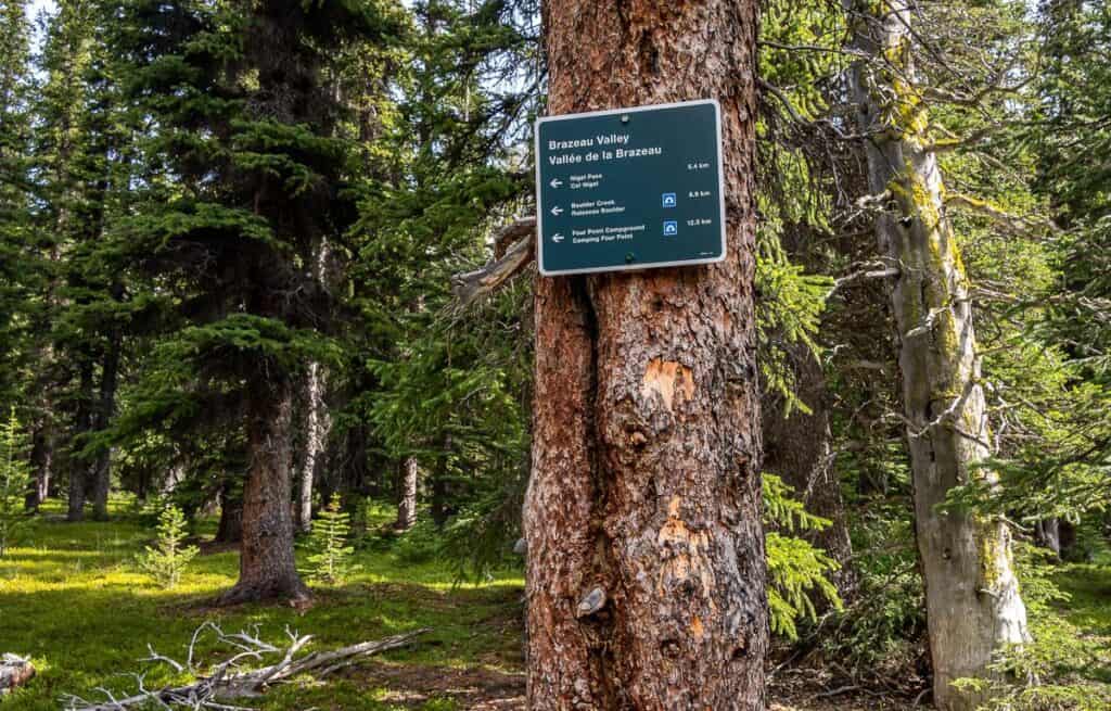
The trail to Nigel Pass is well-signed and in good shape, save for some places where the bears have been busy digging. Once you’ve crossed the Brazeau River and are heading for Cataract Pass, the signage disappears except for a big sign marking the boundary between Banff National Park and Cataract Pass.
The trail is usually obvious though there are places through the boulders where you must sniff out the route. We tried to stay low, close to the river. We had to cross an unmarked snowfield below Cataract Pass, but we could see the trail heading steeply up through the scree to the pass. And we double checked our location on Organic Maps.
Once on the far side of Cataract Pass in the White Goat Wilderness, we just followed our nose and our interest.
Solitude and remoteness
Backpacking to Cataract Pass and beyond takes you deep into remote wilderness—where you’re unlikely to see another soul. If that makes you uncomfortable, it’s probably a good idea to give it a pass. But if you love the thought of a remote hike then this is a great one.
The Great Divide Trail comes up through the White Goat Wilderness Area so you may see some people backpacking it.
Weather Considerations
It was a very different day on the hike out than it was backpacking into the White Goat Wilderness Area. It had rained in the night and again first thing in the morning. The temperature had dropped too.
The bottom line – go prepared for rain and even snow. Pack layers, especially warm, quick dry tops and bottoms. Include a down coat, mitts, and a warm hat. Buy good quality rain gear to stay dry. I like to have a ball cap, so if I pull up my hood, my face gets some rain protection.
What to pack for a backpacking trip to Cataract Pass
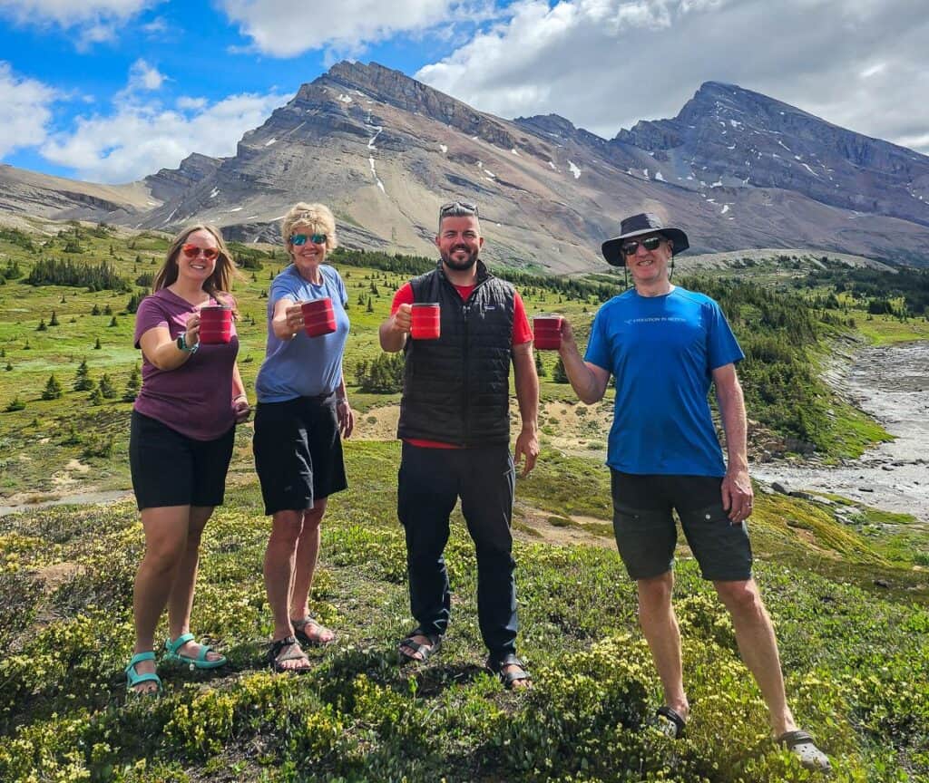
As you can see, the one piece of gear we all brought was the GSI Outdoors Backpacker mug. It’s lightweight, doubles as a measuring cup, and is warm in the hand. It’s also got a press-fit lid to prevent spills.
One of the group brought a tarp – and that’s something we usually pack but I didn’t expect any trees. I’d recommend carrying one tarp per tent. Don’t forget the rope.
Water shoes or Crocs that you can wear across a stream or river are a good idea. They can double as camp shoes.
Carry an InReach Mini 2 or other emergency location device on a backpacking trip to Cataract Pass. The iPhone 14 also works. Thomas has a ZOLEO Satellite Communicator which he said he will now sell because the iPhone worked like a charm – and he was able to text his sister our location – just for the heck of it.
John and I use the MSR 3-person tent which we love for its roominess. Thomas used a one person MSR tent which didn’t show any signs of sagging. It weighs 2.3 kg and offers lots of headroom plus a vestibule.
Nearby hikes you might also like
If you go left at Nigel Pass you can hike the multi-day Brazeau Loop. Unfortunately. there is still a bridge out near Brazeau Lake (from 2024) so until it’s fixed your best off doing an out and back to Jonas Pass Cutoff Campground.
The closest day hike is Parker Ridge – and it’s a good one.
For a two day backpacking trip Sunset Pass and Sunset Lookout make a good combo.
In Jasper National Park, you can do hike into the Geraldine Lakes as a day hiker but also as a backpacker and explore the furthest lake.
Of course, there are more hikes along the Icefields Parkway you’ll love.
Final thoughts on the Cataract Pass hike or backpack
Backpacking to Cataract Pass is a great way to discover another side of Banff National Park – and get a taste of the White Goat Wilderness Area. The landscape is almost surreal at times – and very different with all the crazy rocks than other areas we’ve visited in the park.
I first heard about it from a Great Divide Trail thru hiker at the Jonas Pass Campground on the Brazeau Loop. He said he thought it was the most scenic area between Waterton and the Brazeau Loop. You’ll have to be the judge of that.
Click on the photo to bookmark to your Pinterest boards.
The post Backpacking to Cataract Pass via Nigel Pass appeared first on Hike Bike Travel.